
A Comparative Study of Snyder and Clark Hydrological Procedures for Flood Peaks Estimation
Abstract
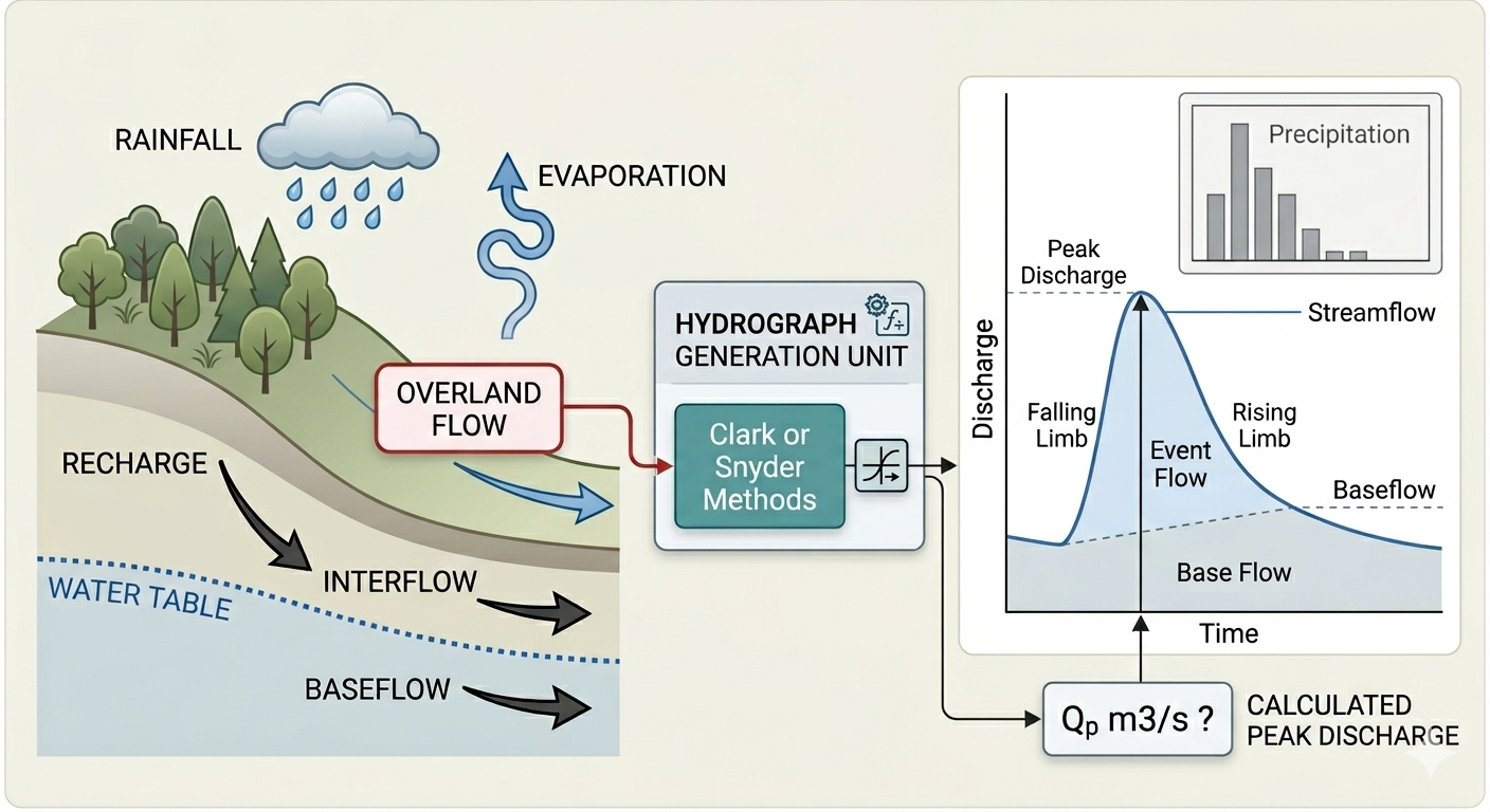
The Snyder (HP11) and Clark (HP27) hydrological procedures are valuable tools in managing water resources in urban and rural areas across Malaysia. This study presents an extensive comparative assessment of these two procedures in estimating different watersheds flood peak flows. A total of 22 watersheds on Langkawi Island were simulated, representing a range of catchment types and characteristics, with catchment areas ranging from 1 to 68.2 km², and slopes between 1.54% to 24.77%, encompassing small to moderately large basins with gentle to steep terrain. For HP11 analysis, a Microsoft Excel spreadsheet was developed and used to perform the analysis based on triangular distribution of direct runoff following Snyder’s method. On the other hand, HEC-HMS software was used to perform hydrological analysis based on HP27 guidelines for both current and future land-use scenarios following Clark Unit Hydrograph Method. Obtained results were analyzed statistically using SPSS covering several parameters and tests. The results showed that the estimated design peak flows using HP11 procedure were higher compared with those estimated using HP27 for same land-use condition especially at higher ARIs. The percentage difference reached more than 70% depends on catchment characteristics. The estimated design peak discharge flows for future land use distribution were increased as expected due to the increment in the imperviousness of the catchment area, which contributes to higher peak discharge values as the critical storm duration shifts to a shorter period. Overall, the study demonstrates that the choice of hydrological procedure has a significant impact on flood estimation and should be carefully considered in future planning and design.
How to Cite
Ebrahim Al-Qadami, Mohd Adib Mohammad Razi, Syed Muzzamil Hussain Shah, Mohamad Fahmi Ideris, Arman Mokhtar, Jaan H. Pu (2026). A Comparative Study of Snyder and Clark Hydrological Procedures for Flood Peaks Estimation. Journal of Engineering and Technological Sciences, Vol. 58 No. 5 (2026): Vol. 58 No. 5(2026): October, 630-640. https://doi.org/10.5614/j.eng.technol.sci.2026.58.5.2
Metrics
References
Ahmad, M. M., Ghumman, A. R., & Ahmad, S. (2009). Estimation of Clark’s instantaneous unit hydrograph parameters and development of direct surface runoff hydrograph. Water Resources Management, 23(12), 2417–2435.
Al-Qadami, E., Razi, M. A. M., Shah, S. M. H., Pu, J. H., Amran, M., Huenchuan, M. A. D., & Avudaiappan, S. (2024). Floodwaters and vehicle hydrodynamics: A deep dive into risk mitigation unraveling vehicle stability in floods. Results in Engineering, 23(2024), 102540.
Ata, F. M., Toriman, M. E., Desa, S. M., San, L. Y., & Kamarudin, M. K. A. (2023a). Development of hydrological modelling using HEC-HMS and HEC-RAS for flood hazard mapping at Junjung river catchment. Planning Malaysia, 21(6), 116-129.
Ata, F. M., Toriman, M. E., Desa, S. M., San, L. Y., & Kamarudin, M. K. A. (2023b). Impact of Land Use Activities On the Hydrological Regime in The Junjung River Basin, Penang Island, Malaysia. Planning Malaysia, 21 (6), 24-56.
Elfithri, R., Mokhtar, M. Bin, & Abdullah, M. P. (2021). Water and environmental sustainability in Langkawi UNESCO Global Geopark, Malaysia: issues and challenges towards sustainable development. Arabian Journal of Geosciences, 14(12), 1168.
Förster, J., Mcleod, E., Bruton-Adams, M. M., & Wittmer, H. (2019). Climate change impacts on small island states: Ecosystem services risks and opportunities. In Atlas of Ecosystem Services: Drivers, Risks, and Societal Responses (pp. 353–359). Springer.
Hassan, M. H., & Ghazali, H. N. (2019). JPS Hydrological Procedures: An Update.
Hussain Shah, S. M., Yassin, M. A., Abba, S. I., Lawal, D. U., Hussein Al-Qadami, E. H., Teo, F. Y., Mustaffa, Z., & Aljundi, I. H. (2023). Flood Risk and Vulnerability from a Changing Climate Perspective: An Overview Focusing on Flash Floods and Associated Hazards in Jeddah. Water, 15(20), 3641.
Iresh, A. D. S., Dilthara, G., & Sugeeshwara, S. P. C. (2024). Estimation of Catchment Parameters of Snyder’s Synthetic Method for Water Resources Planning and Flood Management in Sri Lanka. Engineer: Journal of the Institution of Engineers, Sri Lanka, 57(2), 81-86.
Ismail, H., Kamal, M. R., Hin, L. S., & Abdullah, A. F. (2020). Performance of HEC-HMS and ArcSWAT Models for Assessing Climate Change Impacts on Streamflow at Bernam River Basin in Malaysia. Pertanika Journal of Science & Technology, 28(3), 1027-1048.
Jabbar, L. A., Khalil, I. A., & Sidek, L. M. (2021). HEC-HMS hydrological modelling for runoff estimation in Cameron Highlands, Malaysia. International Journal of Civil Engineering and Technology, 12(9), 40–51.
Jumaat, M. H., Alias, N. E., Yusop, Z., & Haniffah, M. R. M. (2018). Modelling the Flood Scenarios and Land Use Changes in Sungai Selangor Basin. International Conference on Intelligent Information Technologies, 601–611.
Khor, J. F., Lim, S., & Ling, L. (2023). Evaluating the effect of deforestation on decadal runoffs in Malaysia using the revised curve number rainfall runoff approach. Water, 15(7), 1392.
Mohammed, A. F. M., Adnan, M. S., Muneer, A., & Sadeq, S. (2021). Flood Estimation Studies Using Hydrologic Modelling System (HEC-HMS) For Batu Pahat River Malaysia. 2021 Third International Sustainability and Resilience Conference: Climate Change, 225–230.
Rafique, A., Burian, S., Hassan, D., & Bano, R. (2020). Analysis of operational changes of Tarbela Reservoir to improve the water supply, hydropower generation, and flood control objectives. Sustainability, 12(18), 7822.
Rajkumar, S., Mohanarajah, S., & Junaid, H. M. (2019). Effect of Time-Area Percent Curves in Development of Clark Model Unit Hydrograph. Engineer: Journal of the Institution of Engineers, Sri Lanka, 52(1), 29-42.
Ramly, S., & Tahir, W. (2016). Application of HEC-GeoHMS and HEC-HMS as rainfall–runoff model for flood simulation. ISFRAM 2015: Proceedings of the International Symposium on Flood Research and Management 2015, 181–192.
Shah, S. M. H., Mustaffa, Z., Teo, F. Y., Imam, M. A. H., Yusof, K. W., & Al-Qadami, E. H. H. (2020). A review of the flood hazard and risk management in the South Asian Region, particularly Pakistan. Scientific African, 10, e00651. https://doi.org/10.1016/j.sciaf.2020.e00651
Wałęga, A., Grzebinoga, M., & Paluszkiewicz, B. (2011). On using the Snyder and Clark unit hydrograph for calculations of flood waves in a highland catchment (the Grabinka River example). Acta Sci. Pol., Formatio Circumiectus, 10(2), 47–56.
Zanial, W. N. C. W., Malek, M. A., Reba, M. N. M., Zaini, N., Ahmed, A. N., Sherif, M., & Elshafie, A. (2023). Rainfall-runoff modelling based on global climate model and tropical rainfall measuring mission (GCM-TRMM): A case study in Hulu Terengganu catchment, Malaysia. Heliyon, 9(5), doi.org/10.1016/j.heliyon.2023.e15740.
License
Copyright (c) 2026 by Authors

This work is licensed under a Creative Commons Attribution 4.0 International License.
Downloads
Date Log
- Submitted
- October 16, 2025
- Accepted
- June 10, 2026
- Published
- August 11, 2026
Keywords
- clark’s method
- hydrological analysis
- hydrological procedure
- langkawi island
- snyder’s method


